Was it Wikipedia
- Role
- Analysis, mapping
- Data
- Wikimedia Commons, Wikidata
- Methods
- Geosearch on a 400 m grid, spatial counts
Question
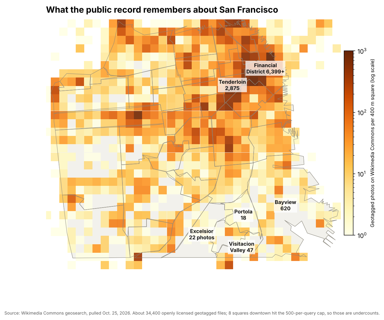
Wikipedia and Wikimedia Commons are becoming the default visual memory of a city, for people and for the AI models trained on them. Whose San Francisco do they remember?
Approach
I split the city into 812 squares of 400 m and counted every geotagged Commons photo and Wikidata place in each one, about 34,000 photos and 2,600 places in all.
Outcome
The record follows visitors' attention. The Tenderloin, Chinatown and the Financial District each hold hundreds of photos per square. The Excelsior, Portola and Visitacion Valley hold one to five.
Only 354 Wikidata places date from before 1950, and 247 photos sit on the city's default map pin, tagged to San Francisco but to nowhere in particular.